
 |
||
|
|
||
|
|
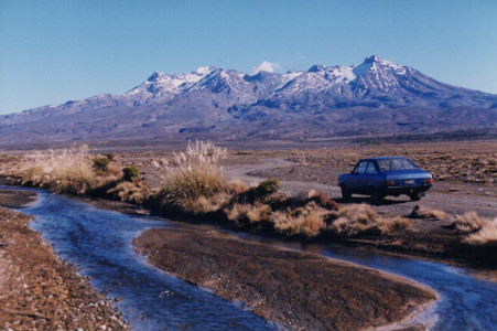
Ruapehu is the highest mountain in North Island, and a remarkably hostile
place to be making a television episode. State Highway 1 crosses the high
plains east of Ruapehu in the 'Desert Road', though the 'desert' is more
like the high deserts of the Andes than the sand of the Sahara. The
intermittent streams are fed mostly by snow-melt.
 |
 |
|
|
|
|
|
|
The Rangipo Desert is on the unfashionable eastern side of the mountain, the only access to the mountain being the rough Tukino Track. The commercial Whakapapa and Turoa skifields are on the west side, where they doubtless get a lot more snow from the prevailing westerly winds. The 'desert' is a high plain of pumice sand and scattered tussock grasses.
'The Mountain' makes its own weather, and can turn from hot sun to a
blizzard very rapidly. On several days a year, State Highway 1 is closed
due to snow. If driving up any tracks, be very careful and do it early
in the day - you don't want to get stuck or bogged miles from the main
road with night approaching. We first visited the place on two occasions - once
in June (well into winter) when there was no snow on the mountain, clear
skies and hot sun all day; and a month later when the whole of New Zealand
was experiencing unseasonally bright sunny weather - except the mountain
which was producing its own blizzards. It does that sort of thing. Occasions
when there is snow on the ground and the mountain is clear, as in Sin Trade,
are just not predictable.
 |
 |
but not quite close enough |
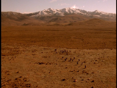
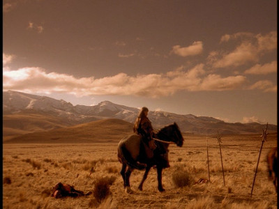
The scene of the horseback battle in The Debt was a major puzzle for a long time.
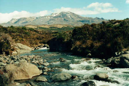
After discovering the river crossing location (see below) just east of the Desert Road, the battle
seemed highly likely to be somewhere in the Ruapehu area - except that every likely location
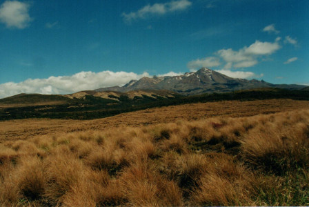
all round the mountain didn't quite 'fit'. The nearest was the tussock country between
the Waihohonu Stream and the Mangatoetoenui Stream - except that it's much too
rough to gallop over. Still, as seen from the road, it's a fair approximation of the
sort of countryside that was used.
 |
 |
|
|
So much for theories...... |
The actual location of the battle scene is twenty miles east of here, on the far side of the bush-clad Kaimanawa Ranges, at the top end of Ngamatea Station. (Rob Tapert mentions the name in the DVD commentary). The mountain in the background is Tawake Tohunga, not Ruapehu. See the Central Plateau page.
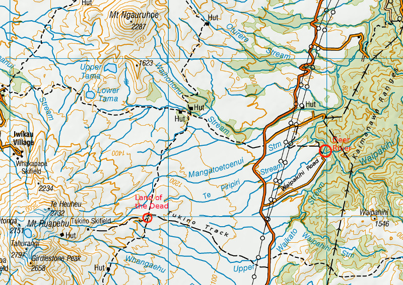
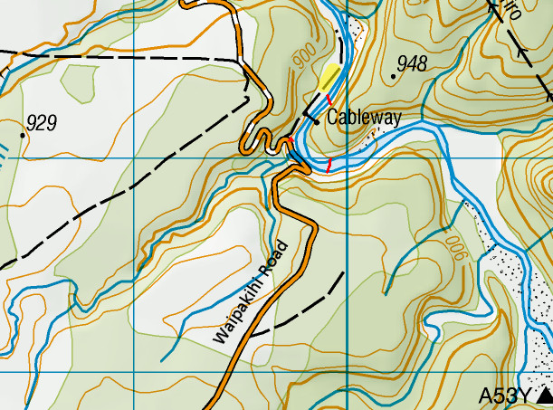
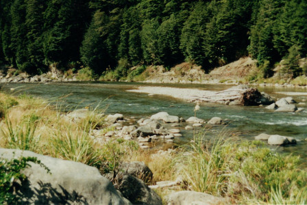
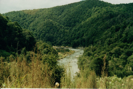
Rather closer is the river crossing scene from The Debt, and the
'deer river' from Sin Trade, on the upper Tongariro River which forms
the sharp boundary between the dry 'desert' in Ruapehu's rainshadow and the
dense bush of the Kaimanawa Ranges. From the main road it's three miles
down Waipakihi Road to the gorge at the end. Warning: these roads towards the river were
built in the seventies for a hydro scheme and haven't been maintained since.
Waipakihi Road now ends in a steep hill down to the riverside, which (in 2000)
was being cut away by the river. By now it may end in a cliff. The tarseal
is breaking up and patches of loose gravel mean that some cars may have
difficulty backing up the hill. If you're not confident of being able to
turn around in a very steep one-lane road, then stop at the top of the
hill and walk down - it's not all that far.
As you descend the hill, straight ahead of you, about 1/2 mile away, is the river that Xena and Gabby crossed in The Debt, shown in the two scans above left. To your right, rather closer, is where we think the second part of that little scene was filmed, with Argo (there are two shots with a fade in between).
 |
 |
 |
|
|
|
|
This is quite a pleasant spot in fine weather, but must have been miserable in the heavy rain while making 'Adventures in the Sin Trade'. Standing here, reflecting on that, gives one a new respect for the dedication of Lucy Lawless and the whole crew.
One gets this feeling even more strongly at the Amazon Land of the Dead.
I'm filled with admiration at the determination and organisation it must
have taken to shoot those sequences. This is at 5000 feet up on the side
of the mountain, five miles up Tukino Track from the Desert Road. The first
four miles of the track is, allegedly, suitable for cars (but beware of
loose sand in stream crossings). Beyond the "Road unsuitable for 2WD cars"
sign is a steep hill littered with big loose rocks, for four-wheel-drives
or cars with lots of ground clearance, driven by determined idiots.
Don't expect help if your car doesn't make it - the track only serves a couple
of ski club huts and if it's not ski season, there may be no traffic at all.
For days.
After the steep rough climb to the communications hut, the track descends slightly to a saddle where there is a small flat area alongside the track moderately clear of rocks and suitable for parking. Beyond this the track climbs to a gate in a gully; immediately beyond this on top of the spur is the main Land of the Dead.
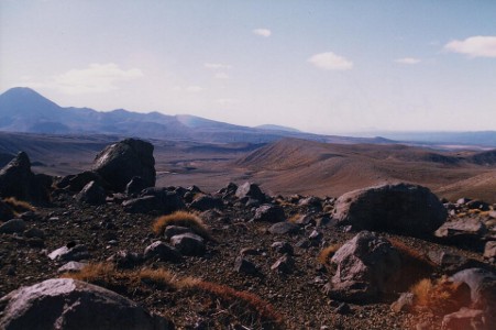
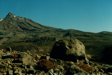
This whole area of mountainside - miles of it - is reddish pumice sand littered with volcanic boulders. When it isn't snow-covered, it looks like the surface of Mars in a low-rent sci-fi movie. On the day of our second visit, there was an intermittent blizzard blowing, snow plastered on rocks and icicles hanging off their leeward sides. However, when Sin Trade was filmed the snowline was much lower still.
Finding particular boulders on a hillside littered with boulders is not straightforward; but for anyone who wants to try, I'll try and give directions.
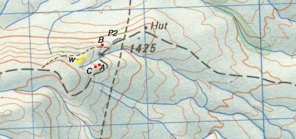
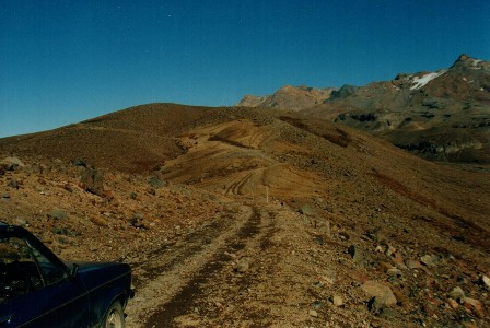
View from the communications hut by point 1425.
The small 'parking area' is on the saddle in the centre of the picture
beyond which the track runs across to the left below the
Land of the Dead
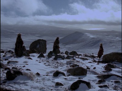
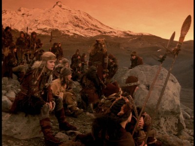
Follow the track on foot up to the (usually locked) gate in the gully. Here the track swings left to go round the end of a spur; on the flattish top of this spur is the most important site of the Land of the Dead. It should be relatively easy to locate Anokin's Rock, a prominent large boulder seen in the sequence where Alti took Xena to meet Anokin.
 |
 |
|
|
Mt Ngauruhoe on left skyline |
Looking across the track downhill to the east, is the Desert Road, State Highway 1, five miles away in full view but invisible in the distance. Distances are deceptive in this country, the edge of the Kaimanawa bush beyond the desert looks like just a mile or two away. It's straight behind Xena and the young dead Amazon as they climb up to meet Cyane.
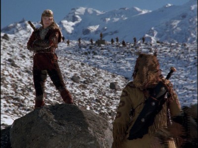
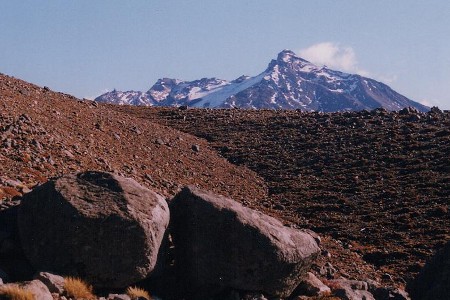
Close by, looking the other way, up the gully and towards the summit of Ruapehu, is Cyane's Rock, the distinctive twin boulders that Cyane stood on (or possibly just behind) when confronting Xena.
 |
 |
|
|
|
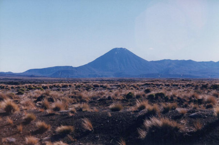
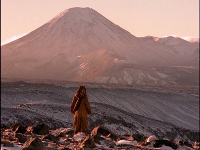
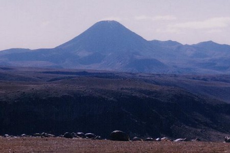
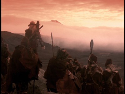
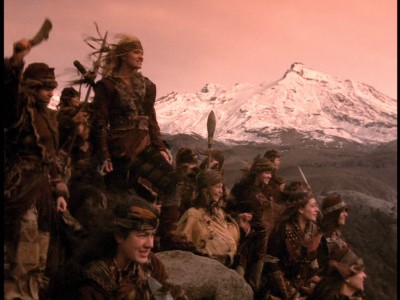
After their meeting, Cyane led the way briskly up the hill, and the next scene truly was in that direction. If you head up and across the gully, to come out on the right-hand ridge by the head of the gully, you're in the right place for the 'walking to the volcano' sequence. Directly to the north from here is the Gateway to Eternity - Mount Ngauruhoe (usually pronounced, rather inaccurately, 'Narra-howey'), a quite unmistakeable silhouette, and the clue that led to locating the Land of the Dead.
 |
 |
|
in the evening light |
from the Tukino Track area (actually, the top of the ridge). |
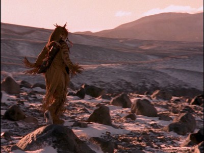
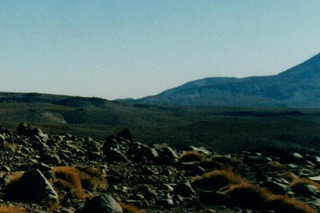
The 'walking to the volcano' sequence was definitely in this spot, since this is the only place where the skylines of Ruapehu and Ngauruhoe intersect in exactly that way. It would be very satisfying to identify some actual rocks to confirm this and fix the spot exactly, but I couldn't.
 |
 |
|
(the Gateway to Eternity) |
seen from the top of the ridge. |
Just on the north side of this ridge is a steep abandoned track that leads back down to the main track just above the 'parking area'. Heading down this track, just before the last steep descent, a few yards to the left is Cyane's second rock - the boulder she was sitting beside at the end of the episode when the Amazons were released.
 |
 |
|
|
|
 |
 |
|
still visible above the clouds |
|

Any comments or questions, email: ![]()