plateau v4
|

|
|
|
New Xenaland
|
|
|
Xena and Hercules Locations
Central Plateau
|
|

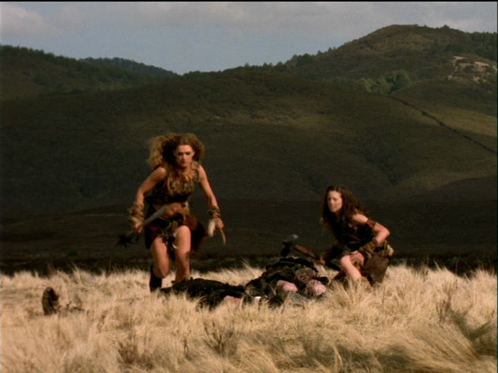
For the plains and mountains of Inner Mongolia in The Debts, the
Sin Trades, and Amazon High,
RenPics went to the high volcanic plateau in the centre of North Island.
Basically the whole central mass of North Island (with a few local wrinkles) can be
thought of as sloping down from Mount Ruapehu to the sea. Much of it is of
volcanic origin, deposited in ash showers from Ruapehu and its neighbours or
from the enormous eruption that created Lake Taupo millennia ago.
The eastern side of 'the mountain' is in rain-shadow and, lower down, is
covered in dry tussock grasses. A few miles further to the north-east
are the thickly bush-clad hills of the northern end of the Kaimanawa Ranges.
To the north and south of these, is more 'high country' covered with tussock.
RenPics used each of these three areas, as a major location for an episode.
Ruapehu, the most
accessible location, has its own page.
Ngamatea and The Debt
We originally guessed that the battle in The Debt was 'somewhere
in the Kaimanawas' before the fortuitous discovery of the river crossing
scene near Ruapehu totally misled us. We subsequently spent much time futilely
thrashing across the countryside around Ruapehu finding many places that were
almost, but not entirely, unlike the battle scene. Should have stuck with our original
guess. It was Rob and Lucy who put us on the right track - well, actually,
said specifically where it was when they mentioned 'Ngamatea' in the DVD
commentary.
The area between the Kaimanawa, Kaweka and northern Ruahine ranges is an
almost empty stretch of 'high country', tussock plains interspersed with gorges,
and the watershed for many rivers. It is traversed by the Taihape-Napier Road
(also known as 'Gentle Annie' after a steep hill on the route) which is a long,
remote road, though now all tarsealed. (In 1972, when I first crossed it at
night in a car rally, it was 70 miles of gravel road amidst vast black emptiness, and it
made a lasting impression on me). Ngamatea is a big high country
'sheep station', one of several such off this road (it even has its own
website),
and all (of course) private property, so inaccessible for sightseeing.
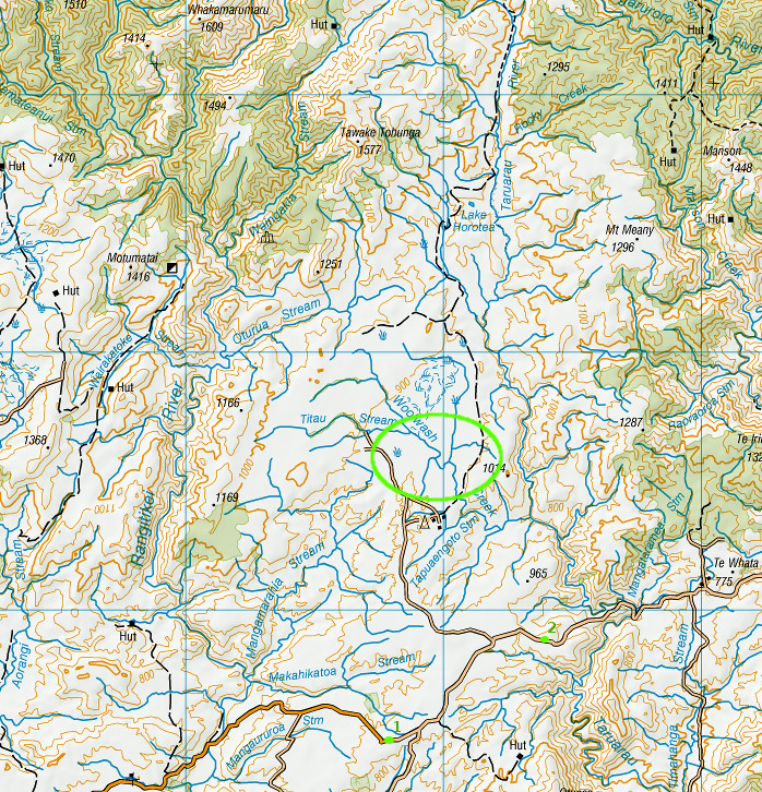
The green circle shows the approximate filming location, so far as we can tell
(an alternative possibility is the basin at the head of the Oturua Stream, 3 miles further north-north-west)
Green dots on the road show the where the long views below were taken from
Click map for large 1:50,000 map (warning 4MB download)
 |
 |
 |
|
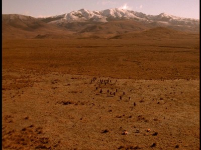
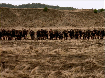
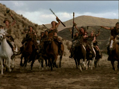
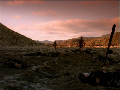
The battle scene in The Debt
|
|
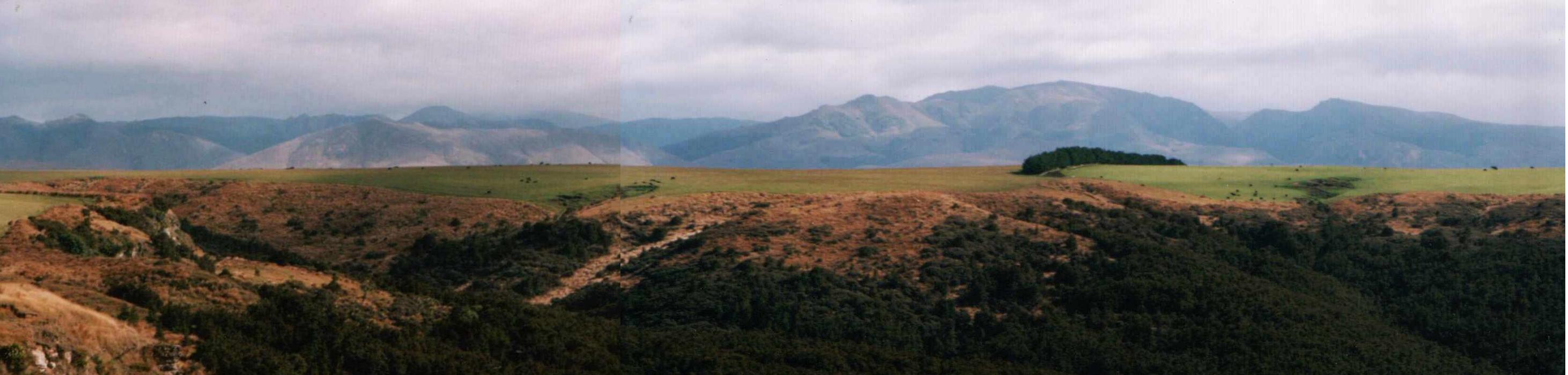
The snow-capped mountain behind the battle scene is Tawake Tohunga (or
Tauwheketewhango - spellings vary, and this one more than most!).
After much careful study of the DVD and detailed 1:50,000 contour maps, I now think the exact
location is the basin of the Woolwash Stream just north of Ngamatea Station farmstead. (We previously
favoured the basin at the head of the Oturua Stream; this is still a possibility).
But I can't be sure. This is four miles from the nearest public access point, the Taihape
Napier Road.
For most of the way across the plateau, past the turnoff to Ngamatea Station,
the Taihape-Napier road is bordered by higher ground which blocks the view to the north.
However, there are two places where a distant view can be obtained - a mile or so west of the
junction with the 'southern' road, before the road starts the long gradual descent westwards to the
Rangitikei River; and a mile east of the Ngamatea Station entrance, where the road
starts the long winding descent eastwards into the gorge of the Taruarau River. These spots are
shown by green dots on the map above.
Views from these two spots are shown below - I've fiddled with the colours to reduce
the distance haze, which is why the colours look a bit odd. The photos were taken at
Easter, in our autumn, hence no snow on the mountains.
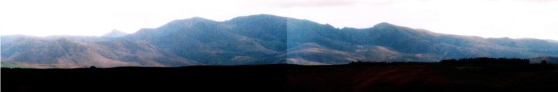
Seen from the western viewpoint (no 1 on the map). The high ground in the foreground
was in cloud shadow, hence black.
The highest point in the background is Tawake Tohunga
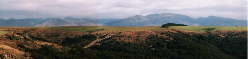
Seen from the eastern viewpoint (no 2 on the map), above the Taruarau gorge.
The battle scene was, I think, 4 miles from the camera and 8 miles from Tawake Tohunga in the distance.
Kaingaroa Plains and Amazon High
Amazon High was filmed as a pilot in late 1997, and some sequences were
used in the Xena episode 'Lifeblood'. According to our informant, it was
filmed at a station called 'Lochinver' off the Napier-Taupo Road and the weather
was extremely cold at the time. This is where the northern fringe of the
Ahimanawa Ranges fades off into the Rangitaiki Plains, and State Highway 5 (the
Napier-Taupo Road) is, along with the Desert Road, the most frequently
closed-due-to-snow road in North Island.
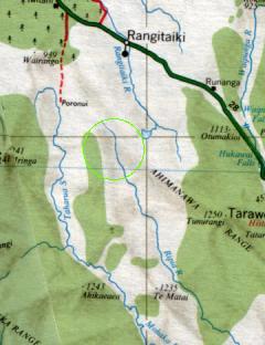
The green circle is our best guess at the
approximate filming location
(click for enlargement)
Lochinver used to have its own website, with a couple of excellent photos of the Repia Valley which appears to
be the scene of the final battle - the flat valley floor and steep cliff-like sides match well. Unfortunately
this site has now disappeared.
 |
 |
 |
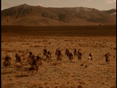
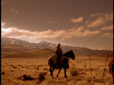
| Attack of the enemy tribe |
The cavalry to the rescue |
Samsara rides off into the sunset |
|

Except where otherwise noted, this work is licensed under a
Creative Commons Attribution-ShareAlike 4.0 International License.
Exceptions are:
The 'New Xenaland' name and logos
Screengrabs and 'stills' from 'Hercules' and 'Xena' which are (C) Renaissance Pictures
Large-scale topographic (contour) maps which are (C) Land Information NZ

Locations
Index
Home
NewXenaland Main
Page
Any comments or questions, email: